

Exploring Geography: The Interactive Map of the United States for Kids
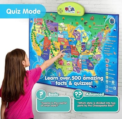
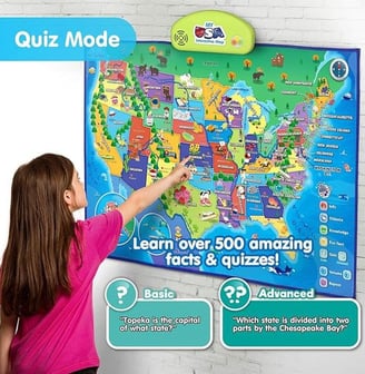
EXPLORE the USA - Learn basic information, climate, general knowledge and fun facts about the 50 States with over 500 facts about all the States. Our interactive with educational values to develop skills such as music, concentration, earth science, memory, problem solving, geography and environment.
11/15/20244 min read

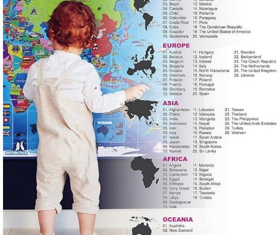
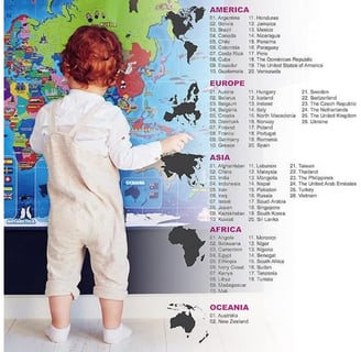
Geography has long been a cornerstone of education, helping children understand the world around them and their place within it. However, traditional methods of teaching geography—using static maps or rote memorization—often fail to inspire young learners. Enter the interactive map of the United States for kids, an innovative tool designed to make geography an engaging and enjoyable experience. By combining education with entertainment, this modern map offers a rich, immersive way for children to explore the diverse landscapes, cultures, and histories of all 50 states.
At its core, the interactive map of the United States transforms the learning process into an exciting journey. Designed with vibrant colors and playful illustrations, the map immediately captures the attention of young learners. Its intuitive interface encourages children to delve into the details of each state by simply touching or tapping on specific areas. This tactile interaction engages their natural curiosity, allowing them to explore state capitals, major cities, unique landmarks, and even regional climates at their own pace.
The inclusion of over 500 educational facts ensures that learning extends far beyond memorizing state names. Kids can discover fascinating tidbits about each state's history, culture, and natural features, fostering a deeper appreciation for the diversity within the United States. For example, they might learn about Alaska’s towering glaciers, Florida’s bustling theme parks, or New Mexico’s rich Native American heritage. This wealth of information helps children develop a comprehensive understanding of the nation while cultivating their love for exploration.
Interactive Features that Engage Young Minds
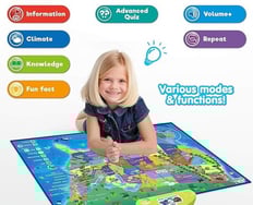
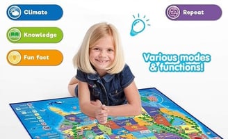
The standout feature of this map is its interactivity. Unlike traditional maps, which are static and often overwhelming for younger audiences, the interactive map is designed to be dynamic and user-friendly. Many models are equipped with touch-sensitive technology that activates state-specific information when pressed. Some even include sound effects, narrations, and engaging quizzes, turning geography lessons into a playful activity.
Quizzes and games are particularly effective in reinforcing knowledge. By challenging kids to recall state capitals, identify geographical features, or match climates to the correct regions, the map promotes active learning and memory retention. These features transform the map into a multi-dimensional educational tool that supports independent exploration while making learning fun and rewarding.
Versatility for Various Learning Environments
The versatility of the interactive map makes it suitable for a wide range of settings, from classrooms to playrooms. Its durable design often includes a fabric frame, allowing it to be hung on walls for group activities or laid flat as a play mat for individual exploration. This flexibility ensures that the map can be seamlessly integrated into various learning environments, adapting to the needs of teachers, parents, and children alike.
For educators, the map serves as an excellent resource for teaching geography, history, and science in an engaging manner. Lessons can be built around its features, such as exploring natural resources or comparing state climates. At home, parents can use the map to supplement their children’s education, fostering quality learning time through interactive play. Whether used as a teaching aid or a standalone activity, the map provides an immersive learning experience that sparks curiosity and encourages exploration.
Building Essential Skills Through Play
Beyond teaching geography, the interactive map helps children develop a range of critical skills. By engaging with the map’s features, kids enhance their memory, problem-solving abilities, and environmental awareness. Understanding the relationships between states, regions, and climates helps them grasp complex concepts such as interconnectivity and cultural diversity.
Moreover, the hands-on nature of the map promotes motor skill development, as children manipulate its interactive components. The quizzes and puzzles embedded in the map also encourage logical thinking and decision-making. These skills, while cultivated in the context of geography, are transferable to other areas of learning, making the map an invaluable tool for holistic development.
The interactive map of the United States for kids represents a significant leap forward in educational tools, blending technology, creativity, and play to make geography accessible and enjoyable. By transforming the learning process into an interactive adventure, it nurtures curiosity and a lifelong love for discovery. In classrooms and homes alike, this map offers an innovative way to teach children about the nation’s rich tapestry of people, places, and stories. In doing so, it not only equips young learners with essential knowledge but also inspires them to explore the world with wonder and excitement.

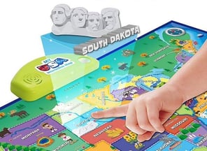
Interactive USA Map for Kids: This foldable and electronic map features touch technology, making it easy for children to engage with and learn about the US geography.
Educational Facts and Quizzes: Contains 500+ facts about 50 states with quizzes to test knowledge about capital cities, climates, and more.
Versatile Design for Learning: Durable fabric frame allows it to be hung on walls or used as a play mat. Ideal for varied learning environments from classrooms to playrooms.
Explore
Engaging tips for kids and tablet usage.
Learn
Play
123-456-7890
© 2024. All rights reserved.